Mill Hill
Overview
The Mill Hill property is part of the Beaver Brook green belt. The land, partly wooded and partly cleared, rises from Beaver Brook to the top of the hill.
The trails pass through mature oak woodlands. Beaver Brook borders the area but is difficult to reach because of thick undergrowth. The land is not well known and shows little use. Unfortunately, the noise level is very high from nearby Route I-495.
Trails
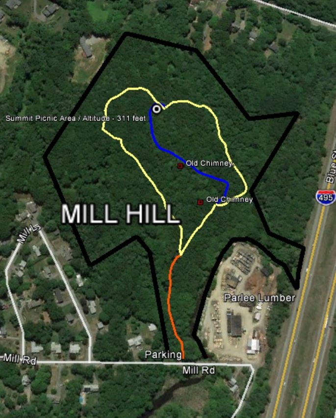
Several, easy trails. One trail leads to a picnic area at the top of the hill where there are three picnic tables.
The wide main trail makes an ideal walking and picnicking area for families with young children and groups of Brownies and Cub Scouts. The trail is an easy climb and offers the hiker many opportunities for nature study - birds, fish, and many varieties of trees and wild flowers.
Directions
Mill Hill lies south of Mill Road, adjacent to the Parlee lumber mill, and borders Beaver Brook by some 700 feet.
Parking: Off Mill Road at the signed entrance.