Sarah Doublet Forest
Overview
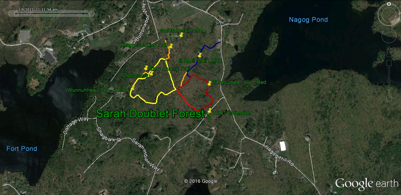
Sarah Doublet Forest is the largest property of the Littleton Conservation Trust. This area is within the historic Nashoba Indian plantation.
Trails
Well-developed and maintained. The kiosk at the parking area has copies of trail maps and other information about the property.
The Knapp-Jenkins Trail (Orange) takes you from the parking area past the old foundation with standing chimney and across the AT&T cable line to the Wunnuhhew Loop (Yellow). This trail goes up and down through overgrown pasture and into pine forest passing an old stone quarry. When you return to the cable line, go down hill a few steps to find the Tatatiquinea Loop (Red) which goes down past some vernal ponds and into a wonderful yellow (in late autumn) area of witch hazel shrubs. You can return on the AT&T line or reverse direction (red markers) on the trails.
Another trail (White) proceeds from the parking lot area downhill to the shore of Fort Pond.
At the intersection of Charter Way and Nashoba Road, a new trail has been established that proceeds northerly through the Nagog Hill Orchard woodlands and private property to Nagog Hill Road. The trail continues on the northerly side of Nagog Hill Road.
Directions
Access is by way of Charter Road (a dirt road) leading off Nashoba Road. A Trust sign is on the corner of this dirt road and Nashoba Road. The dirt road leads to a parking area on the left where another Trust sign is located. Another access way is through the Ed Bell trail starting at the town-owned parking lot on Nagog Hill Road.