Mary Shepherd Conservation Land
Overview
Mary Shepherd Conservation Land features a one-mile trail through woodlands and a meadow within 20.3 acres of town-owned land.
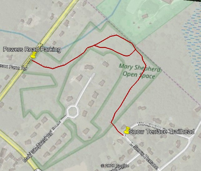
Follow the white markers between the houses at Snow Terrace. The area may look like a yard, but it is town property. The trail follows a forested ridge (called a glacial esker) easterly toward the Westford town line. The trail proceeds northerly down the side of the ridge to an old farm road, which leads to the open field. The trail makes a circular route (follow the worn area in the grasses) around the rear of the new homes to a wet part of the field and into woodlands to a brook. A footbridge crosses the brook. The trail then proceeds up hill to the top of the hill where a parking area is located off Powers Road.
Directions
Access is at the intersection of Snow Terrace and Woodridge Road, where white trail markers are located on trees. Directional signs are posted at sharp turns.
Park on the edge of the road at Snow Terrace.
An alternate parking area and entrance are on Powers Road.